
Psara
Psara is a small island in the North Aegean, 44 square kilometres, lying 22 km northwest of Chios. Bare, rocky and windswept with just 400 residents today in the main village of Psara, it has a rugged coastline with few sandy beaches and a landscape of low hills, scrub and stone walls.
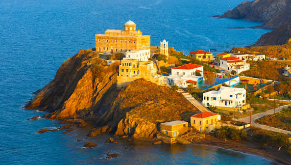
It holds an outsized place in Greek history as one of the great naval powers of 1821, its fleet destroyed in 1824 when Turkish-Egyptian forces massacred almost the entire population of 7,000. The event inspired Dionysios Solomos’ famous poem, “On the blackened ridge of Psara glory is walking alone,” and today the island is quiet and remote, with a small port, war memorials, and a memorial to national hero Konstantinos Kanaris who was born here.
The martyr island of the North Aegean — barren, rocky and historic
Psara, Greek Ψαρά, is a small Greek island centrally located in the North Aegean Sea, 18 kilometres west of Chios, belonging to regional unit of Chios, at latitude 38.5417 longitude 25.5626, altitude 4m, Mediterranean climate Csa. Island area about 40 sq km, also listed as 40.1 km2, about 43 km2 and 45 km2, measures between 7 and 8 km in greatest length and width, population density 10.7 per km2.
Population 420 to 460, 478 inhabitants, about 400 people, capital village Psara with about 400 inhabitants located far southwest on narrow peninsula where harbour is. Native population in 1824 was 7,500 augmented by 23,000 Greek refugees from Chios, Thessaly, Macedonia, Moschonisia and Kydonies before destruction. It is a barren rocky island where little farming takes place, most residents fisherman. Has heliport, monastery Agios Nikolaos, churches Agia Triada, Panagia Vatousena, Koimiseos Theotokou Monastery, and Black Ridge.
Psara island is situated in Aegean Sea west of Chios, has surface area about 43km2 and is inhabited by approximately 400 people. Small population of Mauremys rivulata terrapin survives surprising for dry island.
FYI — why it matters, who it’s for, and what people get wrong
This is for you if you want a remote North Aegean island with heavy history — Destruction of Psara 1824 during Greek War of Independence, martyr island, not tourist mass. It is not for sandy beaches or nightlife — it is barren, rocky, fisherman life, quiet. People think it is near Cyclades — it is North Aegean, 18km off Chios, centrally isolated. Good for birdwatching, fishing, monastery visits and turtle population that survives despite dryness. Ferries are limited and island is small enough to walk but harsh terrain.
Sources
- https://en.wikipedia.org/wiki/Psara | Population 2021 Psara Black Ridge
- https://en.wikipedia.org/wiki/Destruction_of_Psara | native population 7500 augmented 23000 Greek refugees Chios Thessaly Macedonia Moschonisia Kydonies island measures between 7 and 8 km greatest length width
- https://www.greeceguide.co.uk/north-aegean/psara | small Greek island centrally located North Aegean Sea about 40 sq km located 18 kilometres west island Chios barren rocky little farming most residents fisherman capital village Psara about 400 inhabitants village far southwest narrow peninsula harbour
- https://www.biotaxa.org/hn/article/view/36547 | island area 40.1 km2 Psara belongs regional unit Chios island North Aegean Sea Greece dry island not expected
- https://www.greece.com/destinations/north-aegean/chios/psara/ | situated Aegean Sea west Chios surface area about 43km2 inhabited approximately 400 people
Back to all Greek islands
The Greek Island Directory is a project of passion where a love of Crete, Data Integrity and Directories converge to create something truly special for users: Learn More.
Last Updated on August 31, 2026 by admin